Revolutionizing Mining Operations Through Drone Intelligence
The mining industry is rapidly adopting drone technology to drive precision, safety, and sustainability. From stockpile measurements to exploration mapping, drones are transforming how data is collected and decisions are made faster, safer, and more accurately. At Omnisky, we provide the hardware, software, and expertise to help mining operations achieve optimal efficiency and compliance.
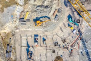
Traditional surveying is time-intensive and exposes personnel to risk. Drones deliver high-resolution aerial imagery, 3D terrain modeling, and LiDAR scans, enabling accurate digital surface models and topographical maps in a fraction of the time.
Improved Safety & Risk Management
Drones replace manual inspections in hazardous zones from unstable pit walls to tailings dams. This allows engineers to assess site integrity and detect instability without putting personnel at risk.
Efficient Stockpile Management
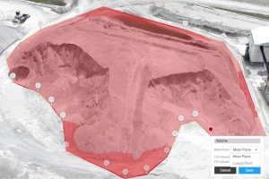
Accurate stockpile measurement is essential for inventory and financial reporting. Drones equipped with LiDAR and photogrammetry sensors deliver centimeter-level accuracy — measuring volumes in minutes instead of days.
Real-Time Monitoring & Progress Reporting
Drones provide live insights into site operations. Supervisors can monitor excavation progress, vehicle movement, and environmental changes in real time — enabling proactive decision-making.
Environmental Compliance and Sustainability
With increased pressure on mines to operate sustainably, drones provide the tools for environmental responsibility. They help track dust levels, water quality, vegetation changes, and rehabilitation progress while ensuring compliance with environmental legislation.
Optimized Blasting and Drilling Operations
Precise data leads to better planning and safer blasting. Drones capture 3D terrain data of blast zones to design optimized drilling grids and charge patterns.
Integrated Inspection & Survey Programs
Omnisky offers inspection and mapping programs tailored for mining environments. Our services integrate AI-powered data analysis and automated reporting, giving you:
Regular stockpile and site surveys
Real-time data dashboards
Regulatory compliance records
Predictive maintenance and environmental monitoring